Thanks for taking the tour!
Push Play button for audio
Please refer to the map below to see where there are hoses to rinse your feet and outdoor showers if you went for a dip in the lake. We hope you enjoyed yourself and learned a bit more about our unique inland sea!
If you want to extend your explorations, you can keep walking down the shoreline towards Saltair. It is the large building east of Great Salt Lake State Park that is topped with many yellow domes.
West of Great Salt Lake State Park is Fritch Island, a nesting place for seabirds. Please maintain a reasonable distance, as these birds are highly territorial of their nesting grounds. The rookery is visible from the gravel frontage road that runs parallel to the highway.
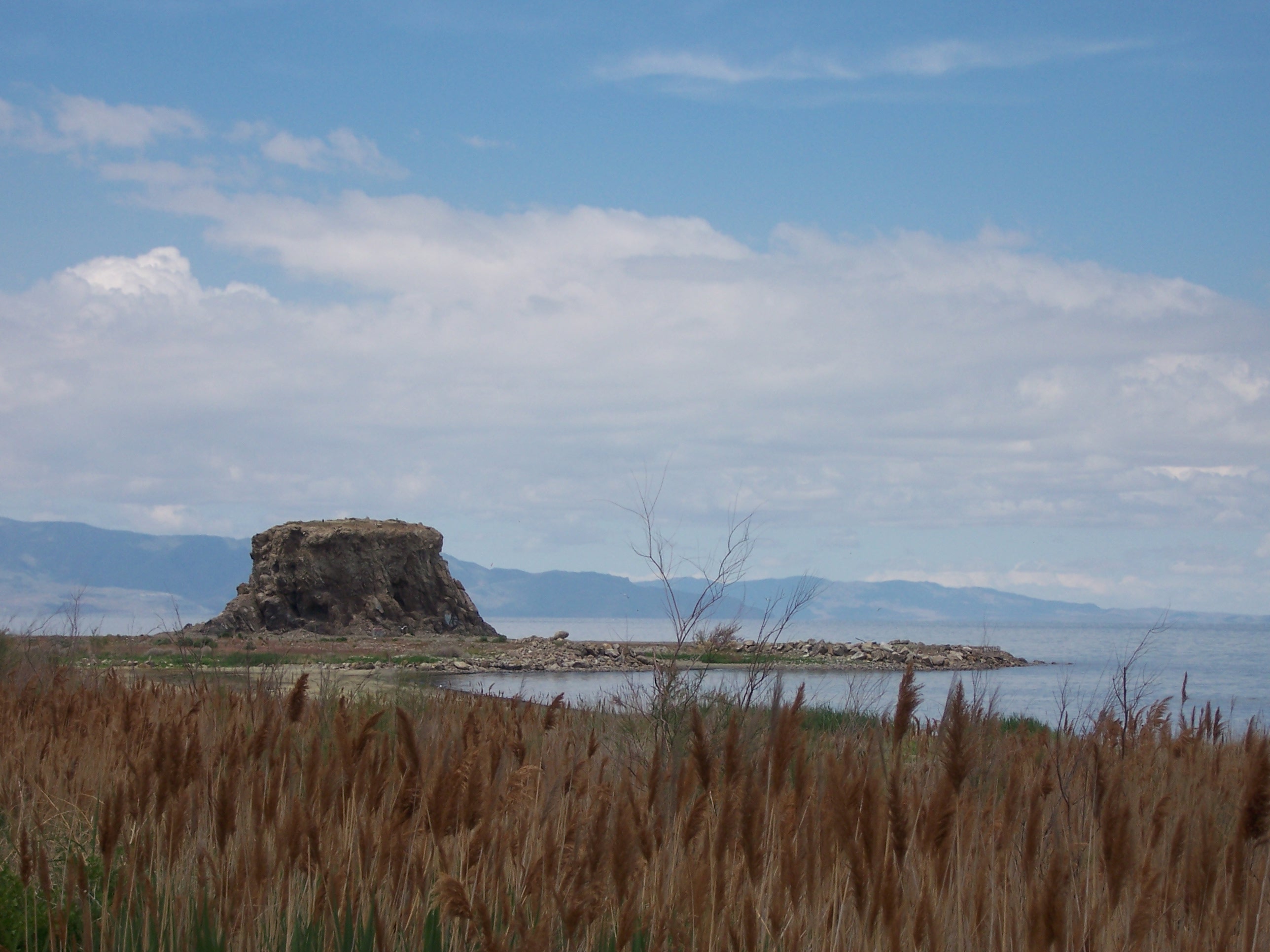
Black Rock
You can also walk or drive further down the gravel frontage road to Black Rock. Black Rock is the site of a lakeside resort that no longer exists and has always been a favorite place for swimming and boating. It is reported that Brigham Young was only in Salt Lake Valley for 3 days before he visited this landmark.
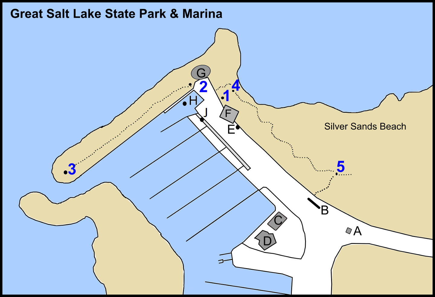
- A: Park Entrance/Exit
- B: Boat Wash, Outdoor Showers, Foot Rinse
- C: Restrooms
- D: Yacht Club & Canoe Club
- E: Foot Rinse
- F: Visitor Center
- G: Observation Deck
- H: Boat Launch
- J: Foot Rinse
Thank you to the donors that helped make this tour possible:
Friends of Utah State Parks
JSI Development
Bringham Young University’s Center for Language Studies
Utah State University’s Department of Language Studies